READ: Types of Plate Boundaries
READ: Types of Plate Boundaries
Each of the different types of plate boundaries is described in more detail below.
Divergent Plate Boundaries
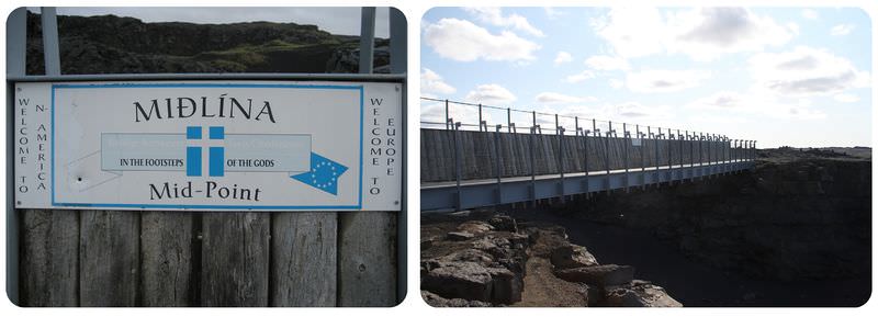
In Iceland, the Mid-Atlantic Ridge is above sea level. It's the only place we can see a mid-ocean ridge out of the water. The Midlina Bridge connects two plates. On the west side is the North American plate. On the east side is the Eurasian plate. A mid-ocean ridge is where new crust is created. Eventually this spot will be beneath the Atlantic Ocean. Plates move apart at a divergent plate boundary. This happens in the oceans at mid-ocean ridges. It happens on land in continental rift zones.
Mid-ocean Ridges
In the oceans, plates move apart at mid-ocean ridges. Lava rises upward, erupts, and cools. Later, more lava erupts and pushes the original seafloor outward. This is seafloor spreading. Seafloor spreading forms new oceanic crust. The rising magma causes the ridge to be buoyant. This is why there is a mountain range running through the oceans. The plates pulling apart cause earthquakes..
Continental Rifting
A divergent plate boundary can also occur within a continent. This is called continental rifting. Magma rises beneath the continent. The crust thins, breaks, and then splits apart. This first produces a rift valley. The East African Rift is a rift valley. Eastern Africa is splitting away from the African continent. Eventually, as the continental crust breaks apart, oceanic crust will form. This is how the Atlantic Ocean formed when Pangaea broke up.
Transform Plate Boundaries
What does a transform plate boundary look like? In the dry part of central California, it looks like this. On one side is the Pacific Plate. On the other side is the North American Plate. Before plate tectonics theory, people thought the San Andreas was just a fault. Now it's known to be a plate boundary!
Two plates may slide past each other in opposite directions. This is called a transform plate boundary. The plates meet at a transform fault. As you might imagine, plates do not slide past each other easily. These plate boundaries experience massive earthquakes. The world’s best known transform fault is the San Andreas Fault in California (figure below). At this fault, the Pacific and North American plates grind past each other. Transform plate boundaries are common as offsets along mid-ocean ridges. They are very small compared to transform faults on land.
Transform plate boundaries are different from the other two types of plate boundaries. At divergent plate boundaries, new oceanic crust is formed. At convergent boundaries, old oceanic crust is destroyed. But at transform plate boundaries, crust is neither created nor destroyed.
The red line is the San Andreas Fault. On the left is the Pacific Plate, which is moving northeast. On the right is the North American Plate, which is moving southwest. The movement of the plates is relative to each other.
Convergent Plate Boundaries
A convergent plate boundary forms where two plates collide. That collision can happen between a continent and oceanic crust, between two oceanic plates, or between two continents. Oceanic crust is always destroyed in these collisions.
Ocean-Continent Convergence
Oceanic crust may collide with a continent. The oceanic plate is denser, so it undergoes subduction. This means that the oceanic plate sinks beneath the continent. This occurs at an ocean trench (Figure below). Subduction zones are where subduction takes place.
Subduction of an oceanic plate beneath a continental plate forms a line of volcanoes known as a continental arc and causes earthquakes.
As you would expect, where plates collide there are lots of intense earthquakes and volcanic eruptions. The subducting oceanic plate melts as it reenters the mantle. The magma rises and erupts. This creates a volcanic mountain range near the coast of the continent. This range is called a continental arc. The Andes Mountains, along the western edge of South America, are a volcanic arc (Figure below).
A relief map of South America shows the trench west of the continent. The Andes Mountains line the western edge of South America.
Ocean-Ocean Convergence
Two oceanic plates may collide. In this case, the older plate is denser. This plate subducts beneath the younger plate. As the subducting plate is pushed deeper into the mantle, it melts. The magma this creates rises and erupts. This forms a line of volcanoes, known as an island arc (figure below). Japan, Indonesia, the Philippine Islands, and the Aleutian Islands of Alaska are examples of island arcs (figure below).
A convergent plate boundary subduction zone between two plates of oceanic lithosphere. Melting of the subducting plate causes volcanic activity and earthquakes.
The country of Japan is an island arc that lies at the intersection of the North American, Filipino, and Eurasian plates. Colors in this picture indicate elevation.
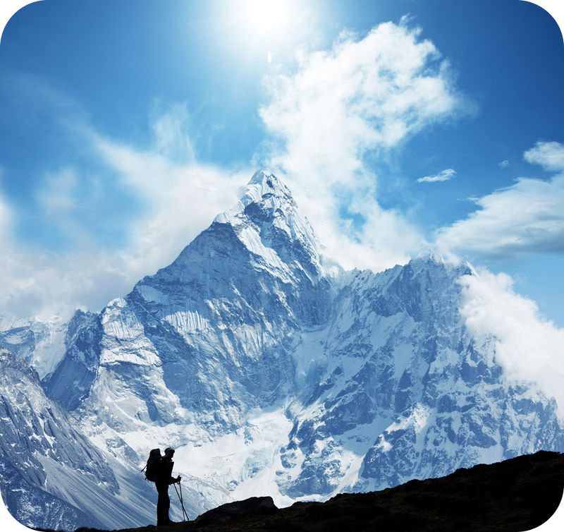
What do you see at a continent-continent convergent plate boundary? Big mountains! The best place to see two continental plates converging is in the Himalaya Mountains. These mountains are the highest above sea level on Earth. They are very popular with mountain climbers.
Another type of convergent plate boundary is when two continental plates collide. Continental lithosphere is low in density and very thick. Continental lithosphere cannot subduct. So when two continental plates collide, they just smash together. This is just like what happens if you put your hands on two sides of a sheet of paper and bring your hands together. The material has nowhere to go but up (figure below)! Earthquakes and metamorphic rocks result from the tremendous forces of the collision. But the crust is too thick for magma to get through. As a result, there are no volcanoes at continent-continent collision zones.
When two plates of continental crust collide, the material pushes upward. This forms a high mountain range. The remnants of subducted oceanic crust remain beneath the continental convergence zone.
Mountain Building
Continent-continent convergence creates some of the world’s largest mountains ranges. The Himalayas (figure below) are the world's tallest mountains. They are forming as two continents collide. The Appalachian Mountains are the remnants of a larger mountain range. This range formed from continent-continent collisions in the time of Pangaea.
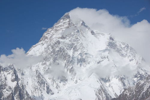
The Karakoram Range is part of the Himalaya Mountains. K2, pictured here, is over 20,000 feet high. The number of mountains this tall in the Himalayas is impressive.
Summary
- Divergent plate boundaries in the ocean create mid-ocean ridges. This is where new seafloor is created by upwelling magma.
- Divergent plate boundaries rift a continent apart. Eventually a new ocean will form between the two continents.
- Iceland is a location where we can see a mid-ocean ridge above sea level.
- At transform plate boundaries, two plates move in opposite direction.
- Transform faults are the site of massive earthquakes.
- The San Andreas Fault is the boundary between the Pacific and North American plates. It is the site of massive earthquakes.
- When two plates come toward each other, they create a convergent plate boundary.
- If at least one plate is oceanic, there will be subduction.
- Subduction of a plate leads to melting and volcanism.
- An island arc is a line of volcanoes on an oceanic plate. A continental arc is a line of volcanoes on a continental plate.
- Continental crust is too buoyant to subduct.
- When two continental plates converge, they smash together and create mountains.
- The amazing Himalaya Mountains are the result of this type of convergent plate boundary.
- The Appalachian Mountains resulted from ancient convergence when Pangaea came together.


